


| Fluckey's Weather Station on Bingham Farms Ln. in Lehi, UT | |||
|---|---|---|---|
| LAST READING AT: 8:09 PM on 7/31/2026 | |||
| CURRENT WEATHER: clear | |||
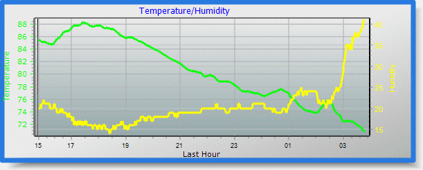
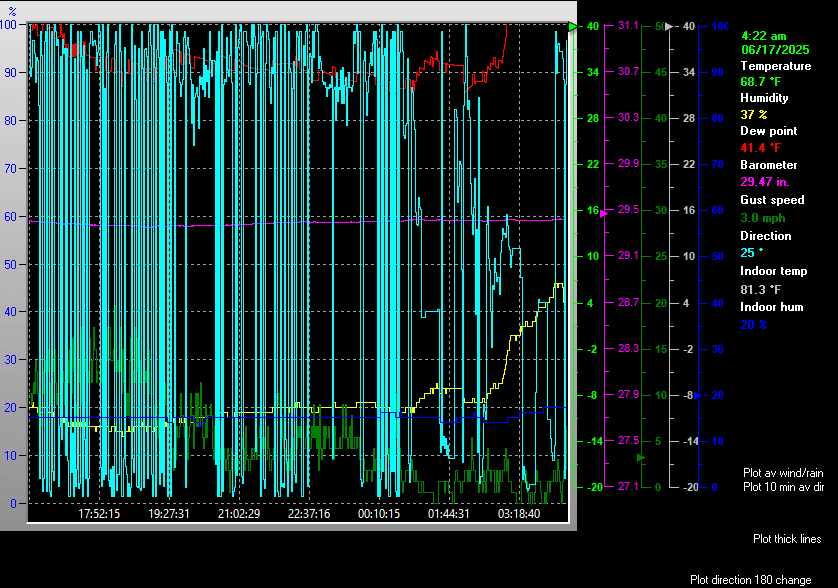
| Current Temperature | 95.8°F | Solar Temperature | 97°F |
| THSW (Temperature/Humidity/Solar/Wind) | 91.6°F | Apparent Temperature | 96.4°F |
| High Temperature (Since Midnight) | 102.5°F @ 6:14 PM | Low Temperature (Since Midnight) | 67.3°F @ 6:09 AM |
| High THSW (Since Midnight) | 100.1°F @ 3:45 PM | Low THSW (Since Midnight) | 66.0°F @ 6:04 AM |
| High Apparent Temperature (Since Midnight) | 113.9°F @ 1:41 PM | Low Apparent Temperature (Since Midnight) | 67.2°F @ 6:40 AM |
| High Solar Temperature (Since Midnight) | 114.0°F | Low Solar Temperature (Since Midnight) | 65.0°F |
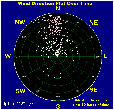
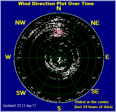
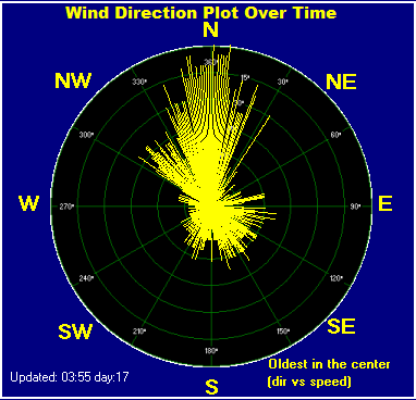
| Average windspeed (Ten Minute) | 8.0 mph | Wind Direction (Ten Minute) | NNE (15 °) |
| Wind Chill / Heat Index | 95.8°F / 91.2°F | Maximum Gust (Last Hour) | 13.0 mph NNE @ 7:18 PM |
| Maximum Gust (Since Midnight) | 15.0 mph / 306° @ 6:51 PM | Maximum 1 minute average (Since Midnight) | 10.4 mph / 1° @ 8:07 PM |
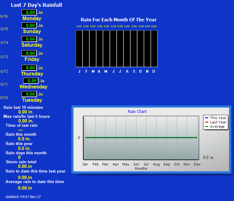
| Rainfall (Last Hour) | 0.00 | Rainfall (Since Midnight) | 0.00 in. |
| Rainfall (This month) | 0.16 in. | Rainfall (To date this year) | 3.98 in. |
| Maximum rain per minute (Last Hour) | 0.00 in./min | Maximum rain per hour (Last 6 Hrs) | 0.00 in. |
| Consecutive Days w/o Rain | 1 (Days From Last Rainfall) | Dew point / Wet Bulb | 37.1°F / 65.1 °F |
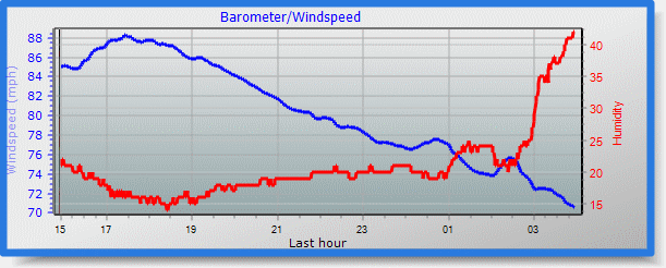
| Humidity / Humidex | 13% / 93.3°F | Barometer (Corrected to MSL) | 29.598 in. (1002.3 hPa) |
| Pressure Change (Last Hour) | +0.002in./hr | Pressure Trend (Last Hour) | Steady |
| Pressure Change (Last 6 Hrs) | -0.083 in. | Pressure Change (Last 12 Hrs) | -0.138 in. |
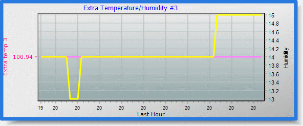
| High Soil Temperature (Since Midnight) | 86°F | Low Soil Temperature (Since Midnight) | 76°F |
| Current Solar Temperature 97°F | |||
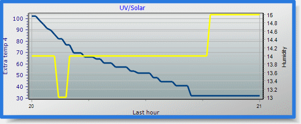
| Current solar | 25 W/m2 | Current UV | 0.0 |
| Maximum solar (Since Midnight) | 912 W/m2 @ 1:31 PM | Maximum UV (Since Midnight) | 6.9 @ 1:09 PM |
| Measurable sunshine hours today: 07:41 and the current sky conditions are: clear | Measurable sunshine hours for the month: | 193:48 hrs | Measurable sunshine hours for the year: | 1154:49 hrs |
| Today solar Kilowatt hour (kwh): 7.5kwh | Month to date solar kwh: | 206.8kwh | Year to date solar kwh: | 1102.4kwh |
| Current evapotranspiration 0.26 inches per day. Yesterday's reading was 0.231 | |||
| Yesterday's Weather | |||
| High Temperature Yesterday | 94.5 °F @ 3:10 PM | Low Temperature Yesterday | 66.9 °F @ 6:12 AM |
| High Barometric Pressure Yesterday | 29.712 in. @ 9:58 AM | Low Barometric Pressure Yesterday | 29.555 in. @ 12:08 AM |
| High Humidity Yesterday | 71% @ 6:14 AM | Low Humidity Yesterday | 19% @ 4:10 PM |
| High Dew Point Yesterday | 61.0 °F @ 9:19 AM | Low Dew Point Yesterday | 43.9 °F @ 4:10 PM |
| High Heat Index Yesterday | 91.8 °F @ 3:10 PM | Low Heat Index Yesterday | 66.9 °F @ 6:12 AM |
| Max Wind Average Yesterday | 23.4 mph WSW @ 3:55 PM | Max Wind Gust Average Yesterday | 33.4 mph SW @ 3:55 PM |
| High Wind Chill Yesterday | 94.5 °F @ 3:10 PM | Low Wind Chill Yesterday | 66.9 °F @ 6:12 AM |
| Rain Yesterday | 0.00 .in | Rain Change Since Yesterday | 0.000 .in |
| High Solar Yesterday | 898.0 @ 2:33 PM | High UV Yesterday | 6.2 @ 1:17 PM |
| Highs And Lows From The Past Week | |||
| High Temperature For Past Week | 103.0°F on Sun | Low Temperature For Past Week | 66.9°F on Thu |
| High Barometric Pressure For Past Week | 29.752 in on Fri | Low Barometric Pressure For Past Week | 29.416 in on Tue |
| High Humidity For Past Week | 72.0% on Wed | Low Humidity For Past Week | 12.0% on Fri |
| High Dew Point For Past Week | 65.1°F on Sat | Low Dew Point For Past Week | 37.1°F on Wed |
| High Heat Index For Past Week | 100.1°F on Sun | Low Heat Index For Past Week | 66.9°F on Thu |
| Max Wind Average For Last Week | 21.9 mph on Wed | Max Wind Gust Average For Last Week | 33.4 mph on Wed |
| High Solar For Past Week | 1076.0 on Mon | High UV For Past Week | 7.5 on Sat |
| Averages From The Past Week | |||
| Average Temperature For Past Week | 84.5°F | ||
| Average Barometric Pressure For Past Week | 29.561in | ||
| Average Humidity For Past Week | 40.7% | ||
| Average Wind For Past Week | 4.0 mph | ||
| Average Wind Gust For Past Week | 6.1 mph | ||
| Rain For Past Week | 0.070 .in | ||
Current Condionts

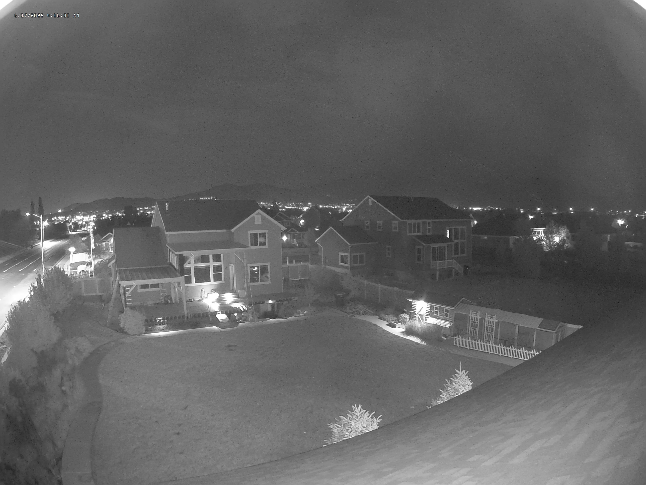
Current WX Pics

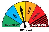
Local Fire Hazard
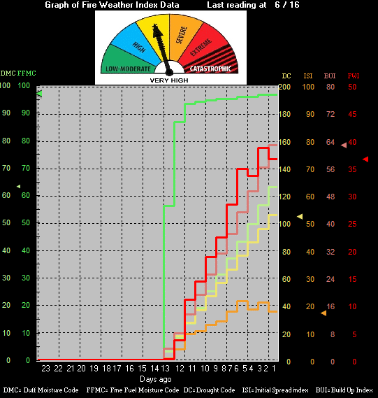
Local Weather Related Fire Index
Auto Scale graphs